RSS
RSS
That Close...
Minutes earlier, the storm had claimed its first victim, a woman whose mobile home was picked up into the air and thrown by the tornado. The air was dense with debris as it crossed Rt. 6 just West of our van, filled with the remnants of structures and trees. Our guide and driver, Meteorologist Matt Van Every, put the van in reverse and began backing away from the circulating mass of rain and shrapnel. Still, the tornado closed on us - it seemed for a few moments that we would be sucked into the vortex. However, Matt assured us that while the wind was howling around us, we were far enough from the inflow (the air being sucked into the tornado) to be safe. He was right. The tornado crossed the road at an angle - so while it appeared to be coming straight for us, it was actually moving into the field adjacent to us.
Our perception of time and distance, I have come to find, are significantly skewed during moments of intense stress. Our first intercept of the Kirksville Tornado seemed to last an eternity and yet only seconds at the same time. I did say first intercept, because our experience with this deadly tornado weren't over yet.
As soon as it was safe, Matt turned the van around and headed back towards Kirksville. The tornado was now chewing through fields to our left, running parallel to us. It intersected electrical lines and several power flashes glowed bright blue over the treetops. Waiting for the tornado in a position to our North was Reed Timmer in the armored SRV. They were able to witness the tornado before it crossed the main road (Rt. 63) that runs North-South through Kirksville. After it moved East of the SRV, it claimed two more victims and collided with a car dealership, flipping many of the vehicles over, and causing extensive damage to homes and businesses there.
As the tornado continued to move East, so did we. We lost sight of the tornado for a few minutes, but found another wall cloud forming directly ahead of us. Based on the radar and visual observations, Matt said the tornado that it would produce would be very large and powerful. As we continued East on Rt. 11, the road curved 90 degrees to the left several miles from downtown Kirksville (many roads in the Midwest are like this - with only a sequence of 90 degree turns instead of a diagonal route, following the outlines of properties and farms). We could see dark clouds ahead and to our left, and the growing wall cloud to our right. As we crested a hill, Matt got a clear look at the dark cloud to the left and realized that it wasn't rain or hail, but a tornado!
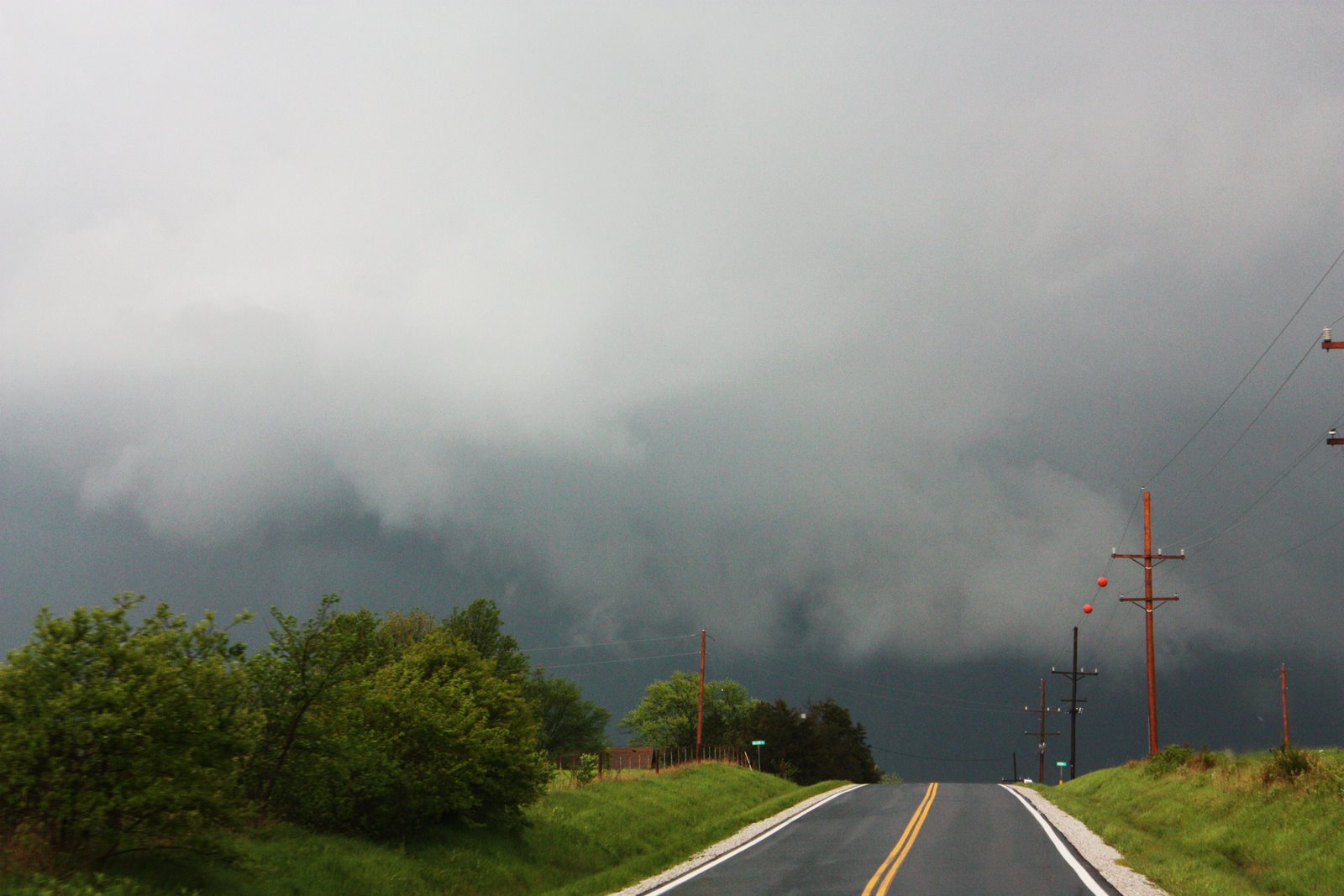 There were two vehicles ahead of us, including one driven by Tim Samaras, a well-respected storm chaser who has been featured by National Geographic. They saw the tornado at almost the same time we did, but they were further up the road, just feet from the oncoming tornado on the crest of the hill. Both trucks were able to turn around in a driveway with only seconds to spare. Had we tried the same maneuver, we would have been hit by the tornado. Instead, we began backing up quickly, but found our exit blocked by other vehicles. As we tried to continue backing up, the trucks ahead of us finished turning around and passed us speeding in the opposite direction, followed by a third truck coming from that direction. This truck, which held a family whose house sat just up the road, was trying to flee the area, but had found its path blocked by the turning vehicles, and was forced to wait directly in the tornado's path as they cleared the road. They were probably less than 150 feet from the tornado as it howled up through a field towards them.
In the air was more debris than we had seen before, and was much larger in size. There were rooftops, large metal sheeting from grain silos, barns, lumber, mangled farm equipment, trees... The sound was deafening. Many people say tornadoes sound like a freight train. I always wondered whether they meant the sound of the train rumbling past or the sound of the train's horn or whistle. I thought it sounded more like a large waterfall, just constant loud rushing, but with a bass note that made the air seem to tremble.
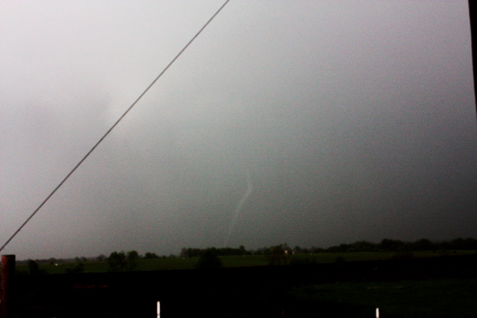
The tornado dwarfed the white farmhouse that stood among some trees on the crest of the hill in front of us. It looked like the tornado would completely destroy it right before our eyes. Luckily, the tornado was about 50 feet North of the house, and spared it, but flattened a road sign just up the road to the ground. It pulled a barbed wire fence, posts and all, straight out from the ground and dragged it across the road. It snapped telephone poles in half like they were matchsticks. But the house stood.
Meanwhile, we were watching the scene unfold directly in front of us, all the time trying to move back, more from the falling debris than the tornado itself. The tornado passed about 150 feet from where we had stopped, but the debris swirling around it was well over our heads and falling all around us, even behind us. This debris cloud racing around the tornado made it appear to be 2 or 3 times larger than it was, although the velocity of the winds was very apparent and very real. As I sat in the front seat of the van, the inflow was sucking all the air, rain and debris around us towards it, but our van held steady. Almost immediately after crossing the road, the tornado lost its strength and dissipated (called roping-out, for the rope-like shape it takes while dying). We drove forward, but found our path blocked by the barbed wire fence, so we turned around, and took pictures of the tornado dying to our East and the damage around us. After that, we decided that we were done chasing for the day and headed back towards downtown Kirksville.
 Only a handful of people in the world have voluntarily done what we accomplished that day - getting within 100 yards of a large and powerful tornado. Not only did we intercept an F3 tornado, but we did it twice, about 8 miles apart. When we headed back to Kirksville, we didn't know the extent of the damage. We didn't know that three people had been killed. We didn't know that homes had been completely destroyed. We didn't know what path the tornadoes had taken. We didn't know that the tornadoes we saw on either side of Kirksville were actually the same one tornado, just eight miles apart.
The following link shows the sequence after we have seen the tornado for the first time, and after we have crossed back across town toward the newly-forming wall cloud:
http://www.youtube.com/watch?v=0uP0eDDag5A
When we drove back into Kirksville, we found most of the town intact. It was quickly getting dark, and access to the Northern part of town was blocked off by emergency personnel. We would return the following day to do a damage survey, and hopefully better understand the sequence of events that left a community forever changed.
Check back this weekend for the results of the damage survey and some of the survey photos.
(Note: the National Weather Service has already completed their damage survey, but with evidence that we collected during the event, and during our own damage survey, we strongly disagree with their rating of EF1-EF2 damage. Our assessment showed strong EF3 damage and evidence of winds approaching and possibly exceeding known windspeeds in the EF4 range. Also note that the EF (Enhanced Fujita) rating is based on surveyed damage and not recorded windspeeds, since there is currently no way* to measure these winds.)
posted by Blake at
11:31 PM
0 Comments
![]()